Ever planned a ride and it’s not quite worked out the way you’d hoped? Did you end up on a busy road or on a cycle path that was more like singletrack? Is it possible to plan a route, rock up and be confident that it will be perfect the first time?
We walk you three bike route navigation services that will help make your next ride great.

Most GPS units have their own inbuilt planners or app-based navigation, but the information isn’t always specific to cycling because the units use Apple or Google as their base. There are, however, a host of route mapping apps and software like Komoot, Strava, and Ride with GPS. You’ll need a paid account to access all the features. Some suit performance and training over navigation and exploration.
Komoot
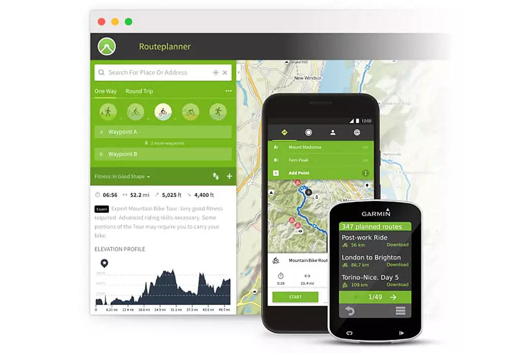
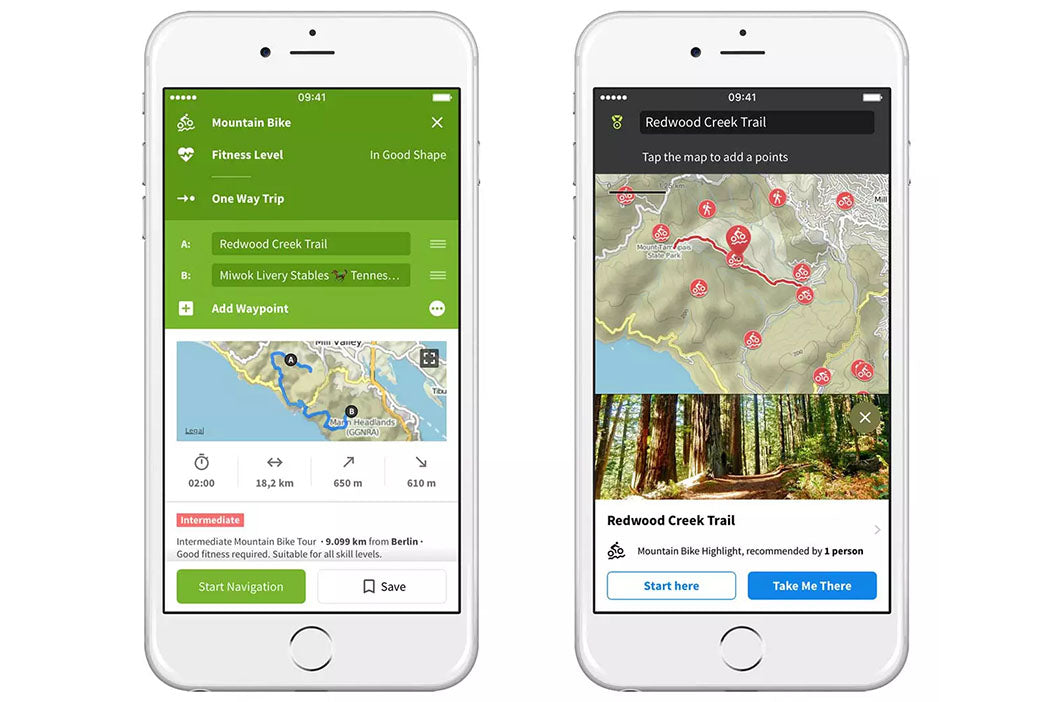
Komoot is a community-based app that relies on user information. Users are encouraged to share highlights and notes about their rides; you can see coffee stops, bike shops, images, and loads of other useful stuff. It draws on this data to help create better rides for you. It also shows really important information like how difficult the ride is, the highest and lowest point, surface and path type cycleway, street, fast A road, unpaved, and cobbled or paved. So when you plot your route, you know exactly what you’re going to ride. It's great for people who want to explore and get off the road, and try out gravel or new MTB routes.

Why is Komoot different?
Komoot doesn't just plan any route — it plans your route. It helps you piece together disparate roads, trails, and everything in between to connect multiple points in the funnest possible way, something that other mapping systems would be hard pressed to do.
In addition, the team at Komoot create routes using heat maps of where people ride to provide smart routing to get you efficiently from A to B. Routes pull in recommendations from local cyclists in the area, be it a great cafe, an awesome stretch of Tarmac, or a well-stocked shop. The points of interest appear on the map as red dots, known as highlights, with images, descriptions, and user comments.
For gravel, off-road, and MTB riders, Komoot analyses the surface to do a better job of sending you on ride-able trails or fire road, not super-steep descents or climbs where you need to get off and hike. You can filter the route by technical difficulty, too.
What are the features?
- Create multi-day routes and have your own collections — upload things you found interesting and images to help other users.
- Syncs route automatically to any Wahoo, Garmin or Suunto computer.
- Turn-by-turn voice navigation via your smart phone.
- Komoot team route suggestions.
- Route info about road type and surface.
- Use offline maps and route on the fly.
- Elevation profile on the app and device.
- Search for routes made by other users.
- Mapping information for on and off road, gravel, trails, and pathways.
What does it cost?
Komoot pricing is based on regions. You can plan routes for free, but you will need to purchase a region to sync it with your GPS device. Region bundles have an £8.99 one off fee, e.g. North Yorkshire or Surrey/Sussex, or get all regions in all countries for £29.99.
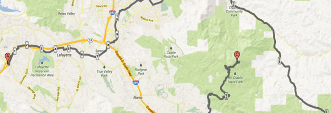
Ride with GPS
Founded in 2007, Ride with GPS was one of the first independent route planning websites, and it converted many away from using Garmin’s own clunky route building software. The app and desktop site have route planning software as well as a sync to your device feature. Using the dashboard panel you can search other users rides in a local area.
Why is Ride with GPS different?
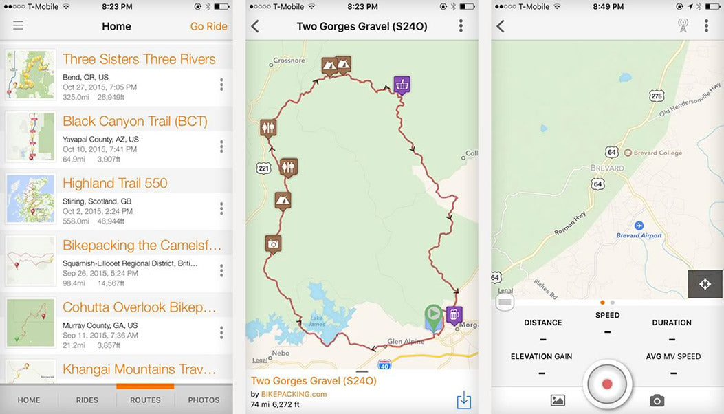
Ride with GPS offers nine map types for you to plot your route. Yes, that is everything from from Google to Topo, terrain, OS Maps and hiking maps, and you can also drop Google's Pegman onto your route and check out the surroundings.
It is free to use from the moment you open an account. Making a route is very easy and quick to do. You can plan routes directly on the app, which is ideal if you need to make changes on the fly, but you'll need to upgrade to the basic account.
The basic and premium accounts open up more features, including global offline mapping, as well as setting when your GPS sends you turn-by-turn messages. In addition, you can add your own custom messages that pop up on your device e.g. "tricky turning - stay right", and there is voice turn-by-turn navigation via the app if you don’t use a GPS cycle computer. You can share your routes using links or embed maps.

What are the features?
- Build, record and sync routes with a free account, and map an unlimited number of routes.
- Estimated ride time.
- Record rides with just the app and auto add rides you've done with friends so you have a history of the routes.
- Route and plan from your phone.
- Share and embed ride routes with friends.
- Optimise your route for walking and cycling — the route auto follows the road.
- Elevation profile on the app and device with predicted key climb information such as gradient and length.
- Sync and send routes directly to paired devices including Wahoo and Garmin.
- Search for routes made by other users, view photos and their notes.
- Print a turn-by-turn cue sheet.
- Premium users have the ability to chop, delete and edit parts of a route without building from scratch.
- Premium users can edit the cue sheet to add in extra information and messages on your GPS device.
What does it cost?
Free, if you want to plot routes on the desktop website and sync them to your device. The basic plan unlocks the features in the mobile app, giving you offline maps and turn-by-turn navigation on your device. (£4.60 per month/£50 per year).
Premium plan is £7.50 per month/£61 per year and you get advance route editing and ability to customise cue sheets and messages on your device.
Strava
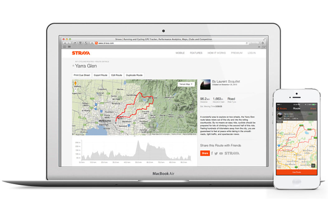
Strava is the social network for athletes. It has grown massively since its launch in 2009, and takes many of the interaction-fostering features found in platforms like Instagram and Twitter, and pairs it with activity tracking technology, like those offered by Ride with GPS or MapMyRun.
Record, track and monitor your training and road rides; like, follow and comment on friends training. When it launched its main draw was the ability to automatically give you a recorded time for specific uphill segments. Strava would then rank your performance on the climb against everyone else in the world. There were also challenges to join and a calendar to track training stats. In the last few years, Strava has added route planning and route sharing features.

Why is Strava different?
The Strava Route Builder is a powerful tool that works best on a desktop computer, much like the Ride with GPS software. It is suited to riders who want to monitor and rank performance and track progress, and works best for road riders.
As you build your road route, you can explore segments and climbs that other users have set times on and plot your route to cover the segments, whilst a heat map setting will show you popular roads.
There is a smart routing feature that makes ride suggestions based on other users' routes. Toggle ‘use popularity’ button and compare Strava's suggestion to your own route. The idea is that the algorithm is meant to find the quickest, safest, and most beautiful roads to ride on.
Strava uses OpenStreetMap, rather than Google, as well as terrain mapping from Mapbox, which means some cycle paths and byways aren’t always shown.
What are the features?
- The ‘local guides’ section features pre-made rides, which you send to your device and follow. However, for the UK, there is only a local guide for the Greater London region.
- Heat maps and segment info to help you plot more interesting routes.
- Turn-by-turn voice navigation via mobile-phone app.
- Edit and remove sections or waypoints using the free account service.
- Elevation profile on the app and device.
- Sync and send routes directly to paired devices including Wahoo and Garmin.
- Print a turn-by-turn cue sheet.
- Elevation profile on the app and device.
What does it cost?
Strava is a free digital service accessible through both mobile application and the web, and for serious users it offers various advanced training features for a monthly payment. Strava offers various paid features, which cost between £1.58 and £4.75 per month.